Maps for Mobile Phones
m (→Sheffield Supertram map) |
m |
||
| (68 intermediate revisions by 2 users not shown) | |||
| Line 1: | Line 1: | ||
| − | |||
| − | |||
{|align=right | {|align=right | ||
|- | |- | ||
| − | |[[Image:Mobinav.png|thumb|Weybridge/UK example map]]||[[Image: | + | |[[Image:Mobinav.png|thumb|180px|Weybridge/UK example map]]||[[Image:NYCSub.png|180px|thumb|NYC subway map]] |
|- | |- | ||
| − | |[[Image:MapUkPart.png|thumb|Political world map]]||[[Image:Map5.png|thumb| | + | |[[Image:MapUkPart.png|thumb|180px|Political world map]]||[[Image:Map5.png|thumb|240px|Political world map]] |
|- | |- | ||
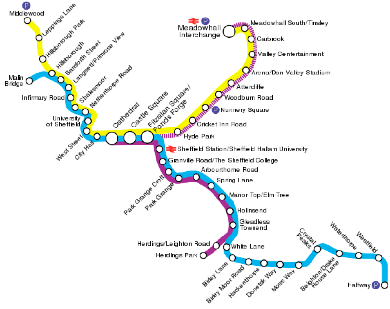
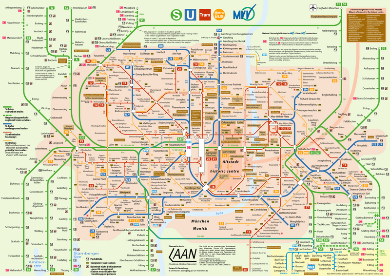
|[[Image:Supertram1.png|thumb|240px|Sheffield ''Supertram'' map]]||[[Image:MunichPublicTransport2006.png|thumb|240px|Public transportation in Munich]] | |[[Image:Supertram1.png|thumb|240px|Sheffield ''Supertram'' map]]||[[Image:MunichPublicTransport2006.png|thumb|240px|Public transportation in Munich]] | ||
| + | |- | ||
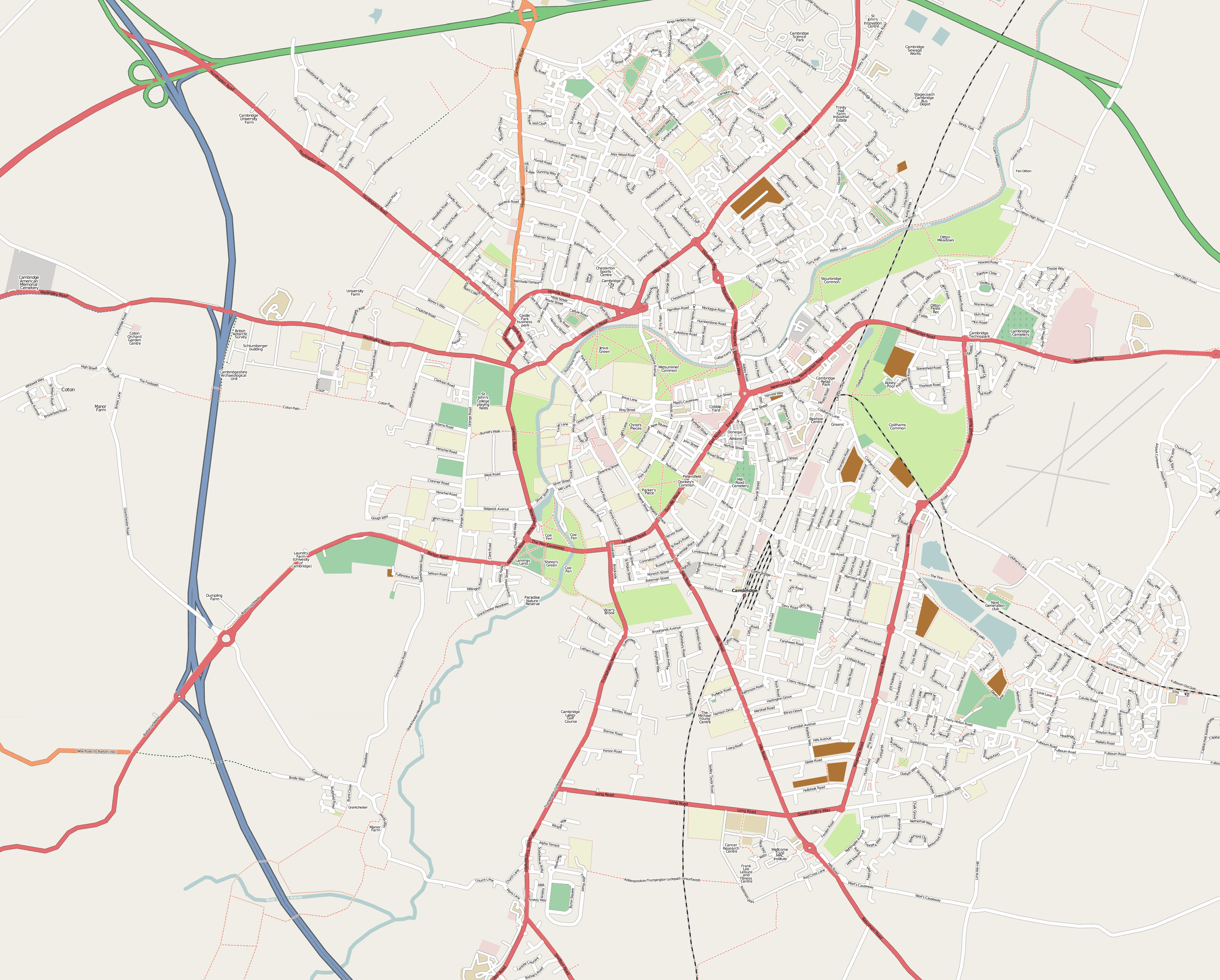
| + | |[[Image:Cambridge.png|thumb|240px|Mobile streetmap of Cambridge (multiresolution)]]||[[Image:VisibleEarth.jpg|thumb|240px|An image created by NASA's [http://visibleearth.nasa.gov/ Visible Earth project]]] | ||
| + | |- | ||
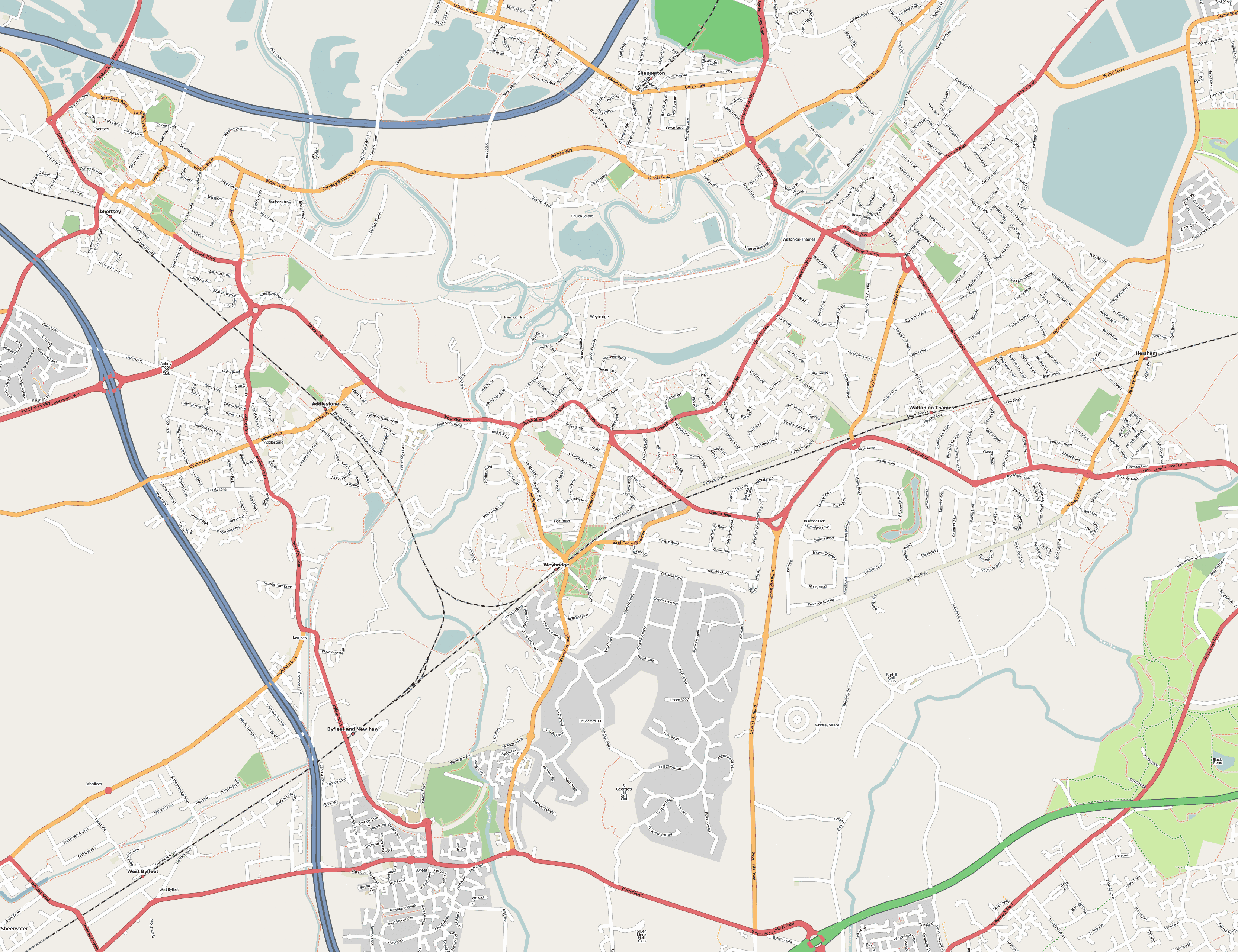
| + | |||[[Image:Weybridge2.png|thumb|240px|Mobile streetmap of Weybridge (multiresolution)]] | ||
|- | |- | ||
|} | |} | ||
| − | == | + | |
| + | =Maps for J2ME mobile phones= | ||
| + | You can download some interactive maps for mobile phones with J2ME/MIDP (Java 2 Micro Edition) as [http://en.wikipedia.org/wiki/JAR_%28file_format%29 JAR] files. If you want to download the file using [http://en.wikipedia.org/wiki/GPRS GPRS] you have to use the link to the ''JAD'' file instead. Please refer to your mobile-phone's manual on how to install Java programs. E-mail [[User:Engjw|me]], if you find a bug in the software. | ||
| + | |||
| + | The size of each software package is mentioned. Note, that temporarily you will need twice as much memory on your mobile, because the JAR-file will only be deleted after installation. You can put comments and submit ratings at [http://www.getjar.net/products/4729/VerkehrsnetzMuenchen getjar.com]. | ||
| + | |||
| + | If you want to compile or emulate the software on your PC, you need to download the [http://java.sun.com/products/sjwtoolkit/download-2_2.html Java 2 Micro Edition (J2ME) Wireless Toolkit]. | ||
| + | |||
| + | ==Weybridge example map== | ||
The map was taken from [http://wiki.openstreetmap.org/index.php/Neat_Stuff openstreetmap.org] (License: [http://www.gnu.org/copyleft/fdl.html GFDL]). | The map was taken from [http://wiki.openstreetmap.org/index.php/Neat_Stuff openstreetmap.org] (License: [http://www.gnu.org/copyleft/fdl.html GFDL]). | ||
* [http://www.wedesoft.demon.co.uk/downloads/MobiNav.jar MobiNav.jar] (191 kByte) Java archive | * [http://www.wedesoft.demon.co.uk/downloads/MobiNav.jar MobiNav.jar] (191 kByte) Java archive | ||
* [http://www.wedesoft.demon.co.uk/downloads/MobiNav.jad MobiNav.jad] description file | * [http://www.wedesoft.demon.co.uk/downloads/MobiNav.jad MobiNav.jad] description file | ||
* [http://www.wedesoft.demon.co.uk/downloads/MobiNav.tar.gz MobiNav.tar.gz] (176 kByte) source code and map-tiles (license: [http://www.gnu.org/copyleft/gpl.html GPL]) | * [http://www.wedesoft.demon.co.uk/downloads/MobiNav.tar.gz MobiNav.tar.gz] (176 kByte) source code and map-tiles (license: [http://www.gnu.org/copyleft/gpl.html GPL]) | ||
| − | * [http://www.wedesoft.demon.co.uk/downloads/splitmap. | + | * [http://www.wedesoft.demon.co.uk/downloads/splitmap.rb splitmap.rb] (638 bytes) source code of Ruby script for splitting up an input file into map-tiles (requires [[HornetsEye]]) |
| + | |||
| + | Note, that for creating map-tiles yourself you need to provide maps for several resolutions (multiresolution pyramid). If you don't have a multiresolution map, you need to scale the input image down to 50% multiple times. You can use the command-line tool ''convert'' which is part of [http://www.imagemagick.org/ ImageMagick] to do this: | ||
| + | |||
| + | convert map.png -scale 50%% map2.png | ||
| + | convert map2.png -scale 50%% map3.png | ||
| + | convert map3.png -scale 50%% map4.png | ||
| + | convert map4.png -scale 50%% map5.png | ||
| + | convert map5.png -scale 50%% map6.png | ||
| + | |||
| + | Note that each dimension of the last pyramid level (here: ''map6.png'') must not be bigger than the tile size (here: ''128'')! | ||
| + | Afterwards you can create the tiles using the Ruby script [http://www.wedesoft.demon.co.uk/downloads/splitmap.rb splitmap.rb]: | ||
| + | |||
| + | ./splitmap.rb map.png 128 5 | ||
| + | ./splitmap.rb map2.png 128 4 | ||
| + | ./splitmap.rb map3.png 128 3 | ||
| + | ./splitmap.rb map4.png 128 2 | ||
| + | ./splitmap.rb map5.png 128 1 | ||
| + | ./splitmap.rb map6.png 128 0 | ||
| + | |||
| + | It is also recommended to compress the resulting map tiles by reducing the number of colours (no dithering!). To do this move the map-tiles into an empty directory and compress the map tiles as follows: | ||
| + | mkdir targets | ||
| + | for i in *.png; do convert $i -depth 8 -colors 32 +dither target/$i; done | ||
==Political world map== | ==Political world map== | ||
| − | The map was taken from the [ | + | The map was taken from the [https://www.cia.gov/library/publications/the-world-factbook/ The World Factbook] (License: public domain). |
| − | * [http:// | + | * [http://vision.eng.shu.ac.uk/jan/WorldMap.jar WorldMap.jar] (1370 kByte) |
| − | * [http:// | + | * [http://vision.eng.shu.ac.uk/jan/WorldMap.jad WorldMap.jad] |
| + | |||
| + | ==Visible Earth== | ||
| + | The picture was taken from the [http://visibleearth.nasa.gov/ Visible Earth project] (License: public domain). | ||
| + | * [http://vision.eng.shu.ac.uk/jan/VEarth.jar VEarth.jar] (1314 kByte) | ||
| + | * [http://vision.eng.shu.ac.uk/jan/VEarth.jad VEarth.jad] | ||
==Munich public transportation map== | ==Munich public transportation map== | ||
| Line 26: | Line 63: | ||
* [http://vision.eng.shu.ac.uk/jan/VerkehrsnetzMuenchen.jar VerkehrsnetzMuenchen.jar] (472 kByte) | * [http://vision.eng.shu.ac.uk/jan/VerkehrsnetzMuenchen.jar VerkehrsnetzMuenchen.jar] (472 kByte) | ||
* [http://vision.eng.shu.ac.uk/jan/VerkehrsnetzMuenchen.jad VerkehrsnetzMuenchen.jad] | * [http://vision.eng.shu.ac.uk/jan/VerkehrsnetzMuenchen.jad VerkehrsnetzMuenchen.jad] | ||
| + | |||
| + | ==New York City Subway Map== | ||
| + | This NYC subway map originated from [http://www.nycsubway.org/maps/spui.html www.nycsubway.org] (License: public domain). | ||
| + | * [http://vision.eng.shu.ac.uk/jan/NYCSub.jar NYCSub.jar] (1657 kByte) | ||
| + | * [http://vision.eng.shu.ac.uk/jan/NYCSub.jad NYCSub.jad] | ||
==Sheffield Supertram map== | ==Sheffield Supertram map== | ||
The map was taken from [http://en.wikipedia.org/wiki/Sheffield_Supertram en.wikipedia.org] (License: [http://creativecommons.org/licenses/by-sa/2.0/ca/deed.en_CA Creative Commons Attribution-ShareAlike 2.0 Canada]) | The map was taken from [http://en.wikipedia.org/wiki/Sheffield_Supertram en.wikipedia.org] (License: [http://creativecommons.org/licenses/by-sa/2.0/ca/deed.en_CA Creative Commons Attribution-ShareAlike 2.0 Canada]) | ||
| − | * [http://vision.eng.shu.ac.uk/jan/Supertram.jar Supertram.jar] ( | + | * [http://vision.eng.shu.ac.uk/jan/Supertram.jar Supertram.jar] (67 kByte) |
| − | * [http://vision.eng.shu.ac.uk/jan/Supertram. | + | * [http://vision.eng.shu.ac.uk/jan/Supertram.jad Supertram.jad] |
| + | |||
| + | ==Cambridge multiresolution map== | ||
| + | Thanks to the work of the [http://www.openstreetmap.org/ OpenStreetMap] community it is now possible to create '''free multiresolution streetmaps for mobile phones'''! Free multiresolution maps is a valuable addition to the worlds inventory of free data. | ||
| + | The data is subject to the terms and conditions of the [http://creativecommons.org/licenses/by-sa/2.0/ Creative Commons Attribution ShareAlike License v. 2.0]. | ||
| + | * [http://vision.eng.shu.ac.uk/jan/Cambridge.jar Cambridge.jar] (1663 kByte) | ||
| + | * [http://vision.eng.shu.ac.uk/jan/Cambridge.jad Cambridge.jad] | ||
| + | |||
| + | ==Weybridge multiresolution map== | ||
| + | Now there also is a free multiresolution streetmap of Weybridge for J2ME mobile phones. The data is provided by the [http://www.openstreetmap.org/ OpenStreetMap] community and subject to the terms and conditions of the [http://creativecommons.org/licenses/by-sa/2.0/ Creative Commons Attribution ShareAlike License v. 2.0]. | ||
| + | * [http://vision.eng.shu.ac.uk/jan/Weybridge.jar Weybridge.jar] (1966 kByte) | ||
| + | * [http://vision.eng.shu.ac.uk/jan/Weybridge.jad Weybridge.jad] | ||
| + | |||
| + | ==Further ideas== | ||
| + | * Sky atlas | ||
| + | * Lunar atlas | ||
=External Links= | =External Links= | ||
| − | * [http://java.sun.com/ | + | * [http://java.sun.com/javame/ Java ME Toolkit] |
| + | * [http://gnuite.com:8080/nokia770/maemo-mapper/ Maemo-Mapper] is a free mobile map software for Nokia 770 (GPL) (hosted at [https://garage.maemo.org/projects/maemo-mapper/ garage.maemo.org]) | ||
| + | * [http://wiki.openstreetmap.org/index.php/GpsMid GpsMid] J2ME displaying multiresolution streetmaps by rendering OSM vector data | ||
* [http://home20.inet.tele.dk/skibsvej47/streetmaps.html Free streetmaps for mobile phones] | * [http://home20.inet.tele.dk/skibsvej47/streetmaps.html Free streetmaps for mobile phones] | ||
* [http://www.ipodsubwaymaps.com/ Download subway maps for iPods] | * [http://www.ipodsubwaymaps.com/ Download subway maps for iPods] | ||
| + | * [http://www.openstreetmap.org/ OpenStreetMap project] now kindly supported by [http://www.multimap.com/ Multimap]! Also see [http://wiki.openstreetmap.org/index.php/Component_overview#Tiles_and_tile_rendering OpenStreetMap component overview]. | ||
* [http://www.openmap.org/ Openmap software] | * [http://www.openmap.org/ Openmap software] | ||
* [http://www.home.fh-karlsruhe.de/~scpa0023/Autobahn.html German motorways (copyrighted)] | * [http://www.home.fh-karlsruhe.de/~scpa0023/Autobahn.html German motorways (copyrighted)] | ||
| + | * This software and other mobile phone applications at [http://www.getjar.com/ getjar.com] | ||
| + | ** [http://www.getjar.com/mobile/19008/worldmap/ WorldMap] | ||
| + | ** [http://www.getjar.com/mobile/4200/shoppinglist Shopping List] | ||
| + | ** [http://www.getjar.com/mobile/329/firstpastthepost FirstPastThePost] is a horce-racing game | ||
| + | ** [http://www.getjar.com/mobile/1155/compass Compass] gives the position of sun and moon to determine true north | ||
| + | ** [http://www.getjar.com/mobile/3076/londonstreetmap London street map] developed by [http://jtrustn.byethost12.com/streetmaps.html JTrustN] | ||
| + | ** [http://www.getjar.com/mobile/17716/chesschampion ChessChampion] | ||
| + | * This software and other applications at [http://softonic.com/ softonic.com] | ||
| + | * [http://tdhutt.googlepages.com/ London Tube Map] (and London Street Map) | ||
| + | * [http://ngphone.com/j2me/opensource/ J2ME open source software] | ||
| + | * [http://www.panayotis.com/yoda/yoda.html Yoda decision maker] | ||
| + | * [http://j2mebomber.sourceforge.net/ Bomber for J2ME] | ||
| + | * [http://www.takechon.net/midp/MoonPhase/ Moon phase calculator for mobile phones] | ||
| + | * [http://www.ecliptomaniacs.com/resources/j2me/ Eclipse Calculator] | ||
| + | * [http://www.piecafe.co.uk/solun/usolun2.htm Solun'-u] is a small planetarium (don't confuse sun and moon, they're both yellow) | ||
| + | * Compare mobile phones at [http://gsmarena.com/ gsmarena.com] | ||
| + | * NASA's [http://visibleearth.nasa.gov/ Visible Earth] project | ||
| + | * [http://www.benhui.net/ benhui.net] has some interesting information on how to use Bluetooth | ||
| + | * [http://tiger.census.gov/cgi-bin/mapbrowse-tbl Tiger Map Server Browser] | ||
| + | * [http://www.mgmaps.com/ Mobile Gmaps] | ||
| + | * [http://www.google.com/gmm/ Mobile Google map client] | ||
| + | * [http://j2memap.landspurg.net/ J2MEmap] | ||
| + | * [http://www.xk72.com/midpssh/ MidpSSH] | ||
| + | {{Addthis}} | ||
[[Category:Projects]] | [[Category:Projects]] | ||
[[Category:Fun-Projects]] | [[Category:Fun-Projects]] | ||
Latest revision as of 23:12, 24 June 2011
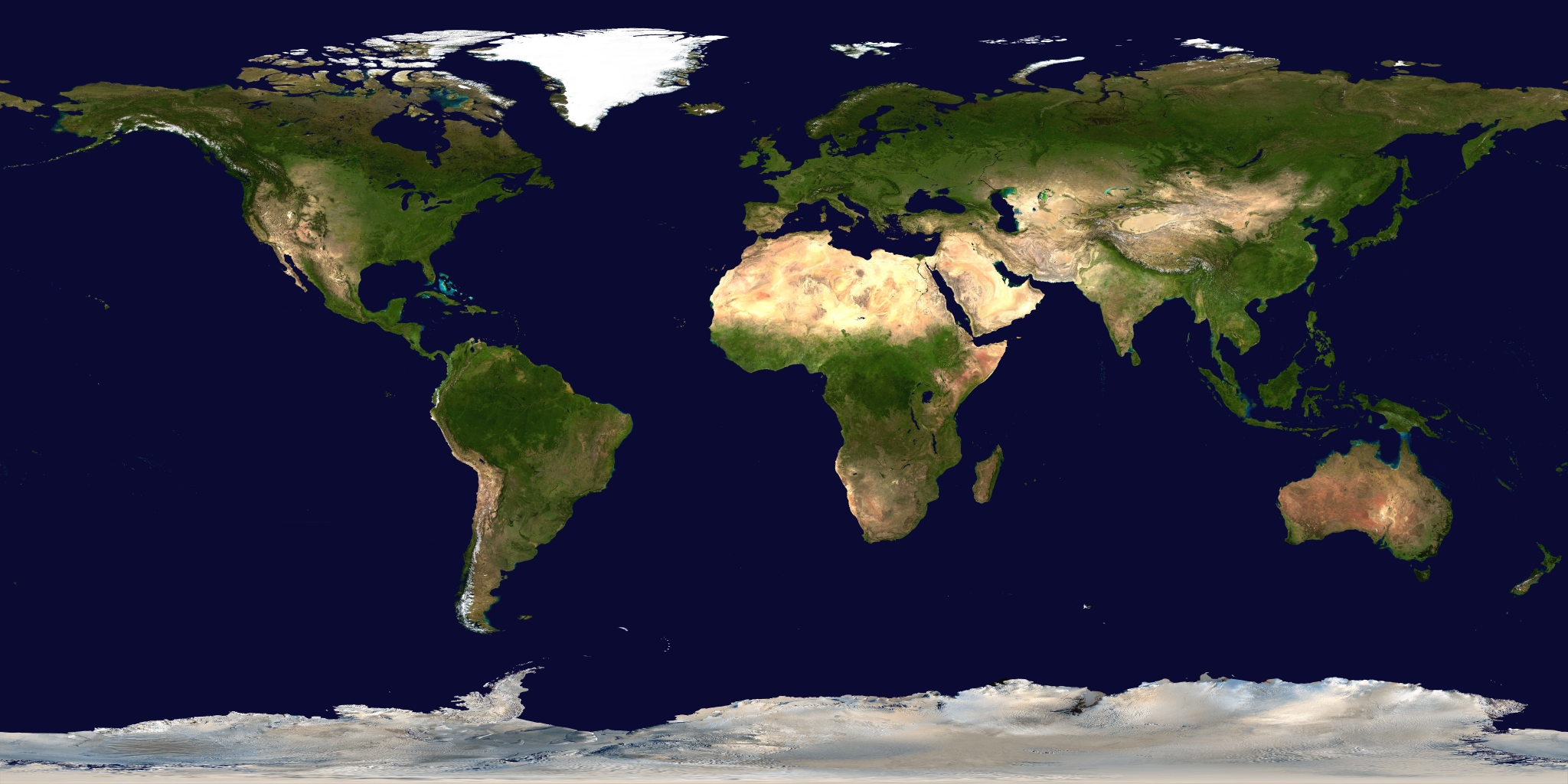 An image created by NASA's Visible Earth project | |
Contents |
[edit] Maps for J2ME mobile phones
You can download some interactive maps for mobile phones with J2ME/MIDP (Java 2 Micro Edition) as JAR files. If you want to download the file using GPRS you have to use the link to the JAD file instead. Please refer to your mobile-phone's manual on how to install Java programs. E-mail me, if you find a bug in the software.
The size of each software package is mentioned. Note, that temporarily you will need twice as much memory on your mobile, because the JAR-file will only be deleted after installation. You can put comments and submit ratings at getjar.com.
If you want to compile or emulate the software on your PC, you need to download the Java 2 Micro Edition (J2ME) Wireless Toolkit.
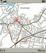
[edit] Weybridge example map
The map was taken from openstreetmap.org (License: GFDL).
- MobiNav.jar (191 kByte) Java archive
- MobiNav.jad description file
- MobiNav.tar.gz (176 kByte) source code and map-tiles (license: GPL)
- splitmap.rb (638 bytes) source code of Ruby script for splitting up an input file into map-tiles (requires HornetsEye)
Note, that for creating map-tiles yourself you need to provide maps for several resolutions (multiresolution pyramid). If you don't have a multiresolution map, you need to scale the input image down to 50% multiple times. You can use the command-line tool convert which is part of ImageMagick to do this:
convert map.png -scale 50%% map2.png
convert map2.png -scale 50%% map3.png
convert map3.png -scale 50%% map4.png
convert map4.png -scale 50%% map5.png
convert map5.png -scale 50%% map6.png
Note that each dimension of the last pyramid level (here: map6.png) must not be bigger than the tile size (here: 128)! Afterwards you can create the tiles using the Ruby script splitmap.rb:
./splitmap.rb map.png 128 5
./splitmap.rb map2.png 128 4
./splitmap.rb map3.png 128 3
./splitmap.rb map4.png 128 2
./splitmap.rb map5.png 128 1
./splitmap.rb map6.png 128 0
It is also recommended to compress the resulting map tiles by reducing the number of colours (no dithering!). To do this move the map-tiles into an empty directory and compress the map tiles as follows:
mkdir targets
for i in *.png; do convert $i -depth 8 -colors 32 +dither target/$i; done
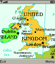
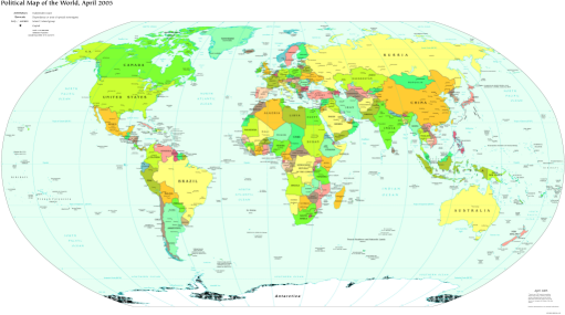
[edit] Political world map
The map was taken from the The World Factbook (License: public domain).
- WorldMap.jar (1370 kByte)
- WorldMap.jad
[edit] Visible Earth
The picture was taken from the Visible Earth project (License: public domain).
- VEarth.jar (1314 kByte)
- VEarth.jad
[edit] Munich public transportation map
The map was taken from de.wikipedia.org (License: GFDL).
- VerkehrsnetzMuenchen.jar (472 kByte)
- VerkehrsnetzMuenchen.jad
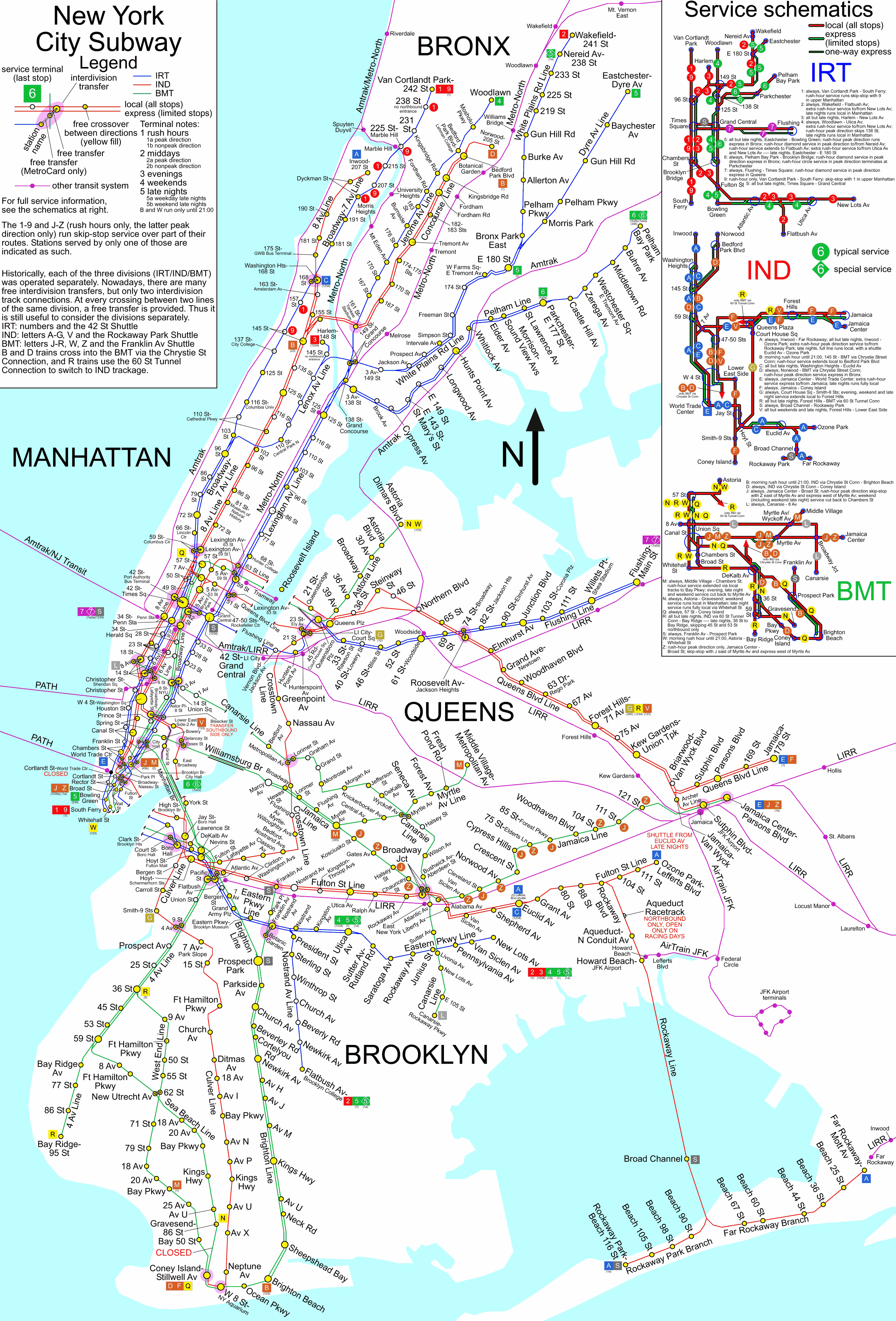
[edit] New York City Subway Map
This NYC subway map originated from www.nycsubway.org (License: public domain).
- NYCSub.jar (1657 kByte)
- NYCSub.jad
[edit] Sheffield Supertram map
The map was taken from en.wikipedia.org (License: Creative Commons Attribution-ShareAlike 2.0 Canada)
- Supertram.jar (67 kByte)
- Supertram.jad
[edit] Cambridge multiresolution map
Thanks to the work of the OpenStreetMap community it is now possible to create free multiresolution streetmaps for mobile phones! Free multiresolution maps is a valuable addition to the worlds inventory of free data. The data is subject to the terms and conditions of the Creative Commons Attribution ShareAlike License v. 2.0.
- Cambridge.jar (1663 kByte)
- Cambridge.jad
[edit] Weybridge multiresolution map
Now there also is a free multiresolution streetmap of Weybridge for J2ME mobile phones. The data is provided by the OpenStreetMap community and subject to the terms and conditions of the Creative Commons Attribution ShareAlike License v. 2.0.
- Weybridge.jar (1966 kByte)
- Weybridge.jad
[edit] Further ideas
- Sky atlas
- Lunar atlas
[edit] External Links
- Java ME Toolkit
- Maemo-Mapper is a free mobile map software for Nokia 770 (GPL) (hosted at garage.maemo.org)
- GpsMid J2ME displaying multiresolution streetmaps by rendering OSM vector data
- Free streetmaps for mobile phones
- Download subway maps for iPods
- OpenStreetMap project now kindly supported by Multimap! Also see OpenStreetMap component overview.
- Openmap software
- German motorways (copyrighted)
- This software and other mobile phone applications at getjar.com
- WorldMap
- Shopping List
- FirstPastThePost is a horce-racing game
- Compass gives the position of sun and moon to determine true north
- London street map developed by JTrustN
- ChessChampion
- This software and other applications at softonic.com
- London Tube Map (and London Street Map)
- J2ME open source software
- Yoda decision maker
- Bomber for J2ME
- Moon phase calculator for mobile phones
- Eclipse Calculator
- Solun'-u is a small planetarium (don't confuse sun and moon, they're both yellow)
- Compare mobile phones at gsmarena.com
- NASA's Visible Earth project
- benhui.net has some interesting information on how to use Bluetooth
- Tiger Map Server Browser
- Mobile Gmaps
- Mobile Google map client
- J2MEmap
- MidpSSH
