File:Weybridge.png
From MMVLWiki
(Difference between revisions)
(Map of Weybridge/UK. Source: [http://wiki.openstreetmap.org/index.php/Neat_Stuff openstreetmap.org] (GFDL)) |
m |
||
| Line 1: | Line 1: | ||
Map of Weybridge/UK. Source: [http://wiki.openstreetmap.org/index.php/Neat_Stuff openstreetmap.org] (GFDL) | Map of Weybridge/UK. Source: [http://wiki.openstreetmap.org/index.php/Neat_Stuff openstreetmap.org] (GFDL) | ||
| + | |||
| + | {{CP-Cc-by-sa-2.0}} | ||
Latest revision as of 17:17, 3 April 2006
Map of Weybridge/UK. Source: openstreetmap.org (GFDL)
| |
This image is licensed under the Creative Commons Attribution ShareAlike License v. 2.0: http://creativecommons.org/licenses/by-sa/2.0/ |
File history
Click on a date/time to view the file as it appeared at that time.
| Date/Time | Thumbnail | Dimensions | User | Comment | |
|---|---|---|---|---|---|
| current | 21:44, 30 March 2006 | 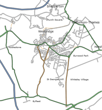 | 360 × 387 (115 KB) | Engjw (Talk | contribs) | (Map of Weybridge/UK. Source: [http://wiki.openstreetmap.org/index.php/Neat_Stuff openstreetmap.org] (GFDL)) |
File usage
The following page links to this file: